UrbanShift Geospatial Planning Lab in Puducherry: Understanding Climate Hazards and Co-Creating Resilience
For two days, key stakeholders gathered to explore how geospatial data can inform local solutions to heat, flooding, and cyclone-related risks.

Puducherry is increasingly facing complex and overlapping climate risks, from coastal flooding and cyclones to rising urban heat. In response, UrbanShift organized a two-day in-person lab in Puducherry, bringing together 57 local government officials, planners, experts, and community leaders to explore how geospatial data can be used to co-create inclusive, resilient solutions.
Through hands-on exercises, site visits, and technical presentations, the Lab examined how different climate hazards—urban heat, stormwater flooding, and cyclone-related surges—manifest across Puducherry’s neighborhoods. Participants engaged directly with spatial data, contribute local knowledge, and collaboratively identify solutions that reflect Puducherry’s needs and priorities.
The Lab focused on three core focus areas:
-
Urban Heat: Leveraging high-resolution satellite and local datasets to assess heat stress in vulnerable neighborhoods and identify greening opportunities.
-
Flooding: Using geospatial modeling to evaluate flood risk zones and stormwater infrastructure capacity.
-
Cyclones & Wind: Assessing exposure to wind-related hazards and storm surges through scenario analysis and risk mapping.
Across both days, sessions included:
-
Technical presentations on local climate data
-
Case studies from cities like Chennai and others in Tamil Nadu
-
Field visit to flood-prone neighborhoods in Puducherry
-
Collaborative exercises to design adaptation strategies and prioritize nature-based and people-centered interventions
-
Action planning to explore technical, financial, regulatory and governance feasibility of proposed solutions
Speakers:
- Bina Shetty, Program Head, Spatial Data and Data Analytics, WRI India
-
Gorka Zubicaray, Urban Development Senior Technical Specialist, WRI Mexico
-
John-Rob Pool, Senior Manager, UrbanShift & Nature-positive Urban Development, WRI
-
Raj Bhagat Palanichamy, Senior Program Manager, Sustainable Cities & Transport, WRI India
-
Dr Kirthiga SM, Program Manager, Geo Analytics Cities Program, WRI India
-
Dr Priya Narayanan, Program Manager, Urban Development, WRI India
-
Dr Nambi Appadurai, Director, Climate Resilience Practice, WRI India
-
Avantika Arjuna, UrbanShift Country Coordinator for India, ICLEI South Aisa
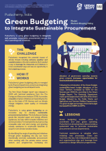
Puducherry, India: Green Budgeting to Integrate Sustainable Procurement
Model: Market-Shaping Policy & Regulation

Meet CityMetrics: An Open-Source, Interactive Tool for Analyzing Urban Risks and Opportunities
With CityMetrics, a new geospatial data platform developed by WRI, over 60 cities--including all 23 UrbanShift cities--can access in-depth data on urban risks and vulnerabilities.

UrbanShift at COP30
UrbanShift will be participating in a range of events during the Local Leaders Forum in Rio and COP30 in Belém. Learn more here.
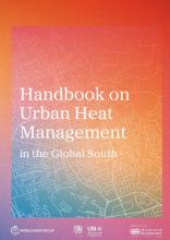
Handbook on Urban Heat Management in the Global South
The Handbook helps cities take action by offering practical guidance to assess heat risk, plan resilience strategies, and implement solutions such as green infrastructure, passive cooling, and sustainable cooling systems.
